|
Finding History Hidden In Plain Sight |
|
|
| Chapter
6. We find the home of Robert Evans! |
|
|
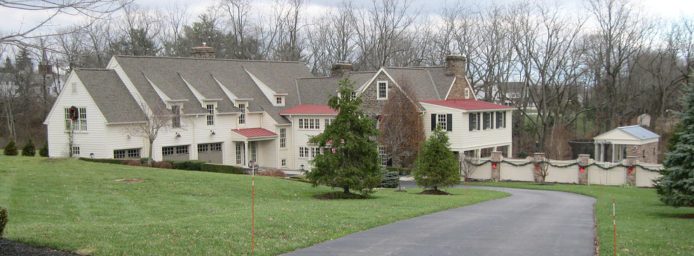
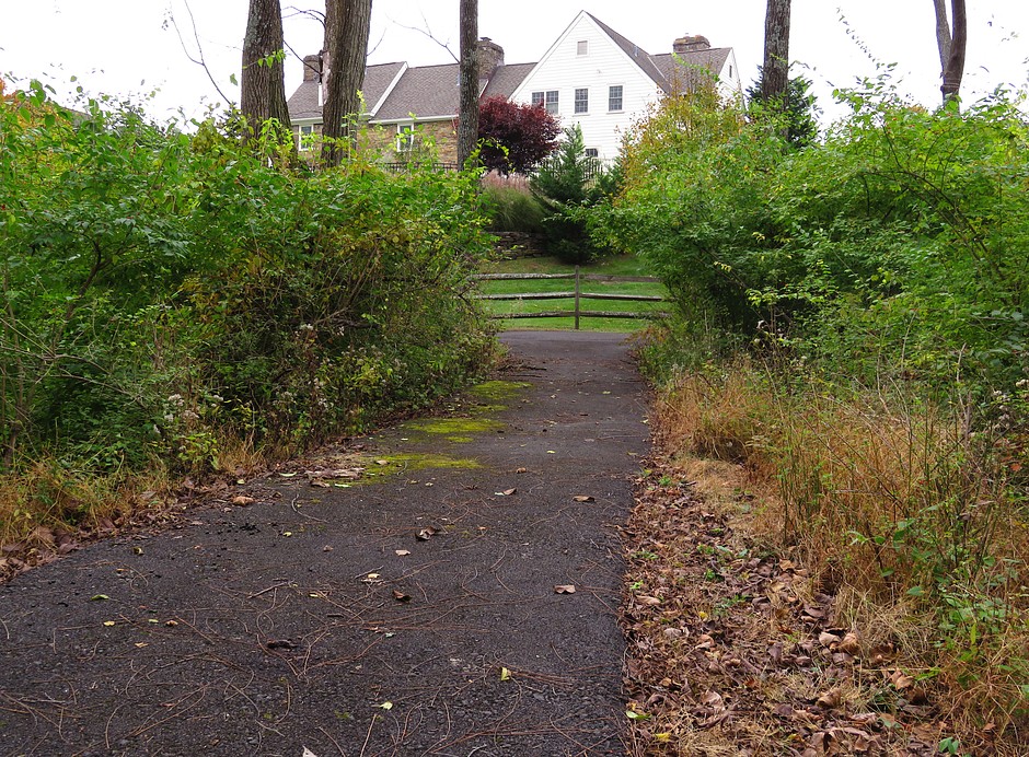
One day in 2014 we were out walking along Penn
Oak Drive, and as we approached the new house under
construction I looked at the house next to it. I said to
Andrea, "Hey! Lookit the top window in that house!" "What
about it?" she asked. "Look at the window on the right! The
small window at the top! It's Robert Evans' house! We've
found it!" |
|
| |
|
|
|
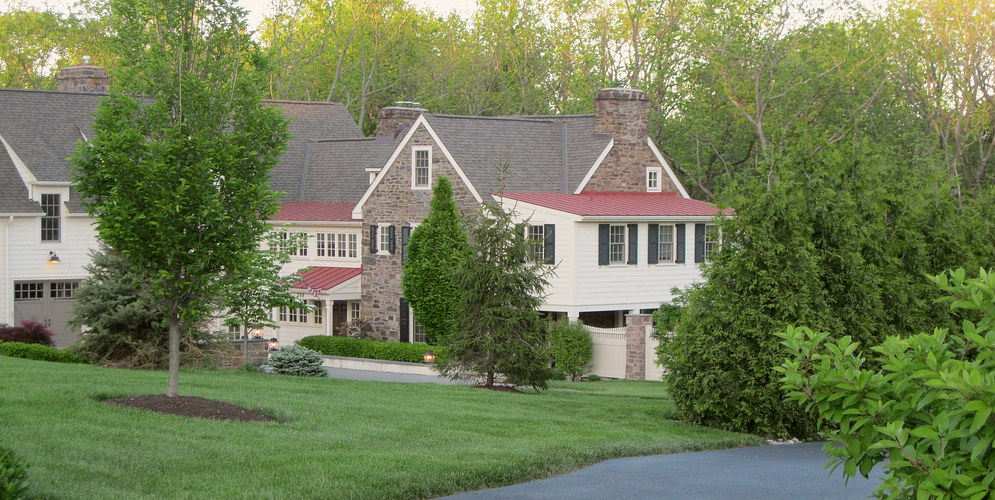
| The house
has so many additions on it we walked past it a hundred times and
never noticed the little window at the top. |
| |
|
|
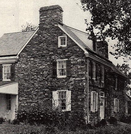
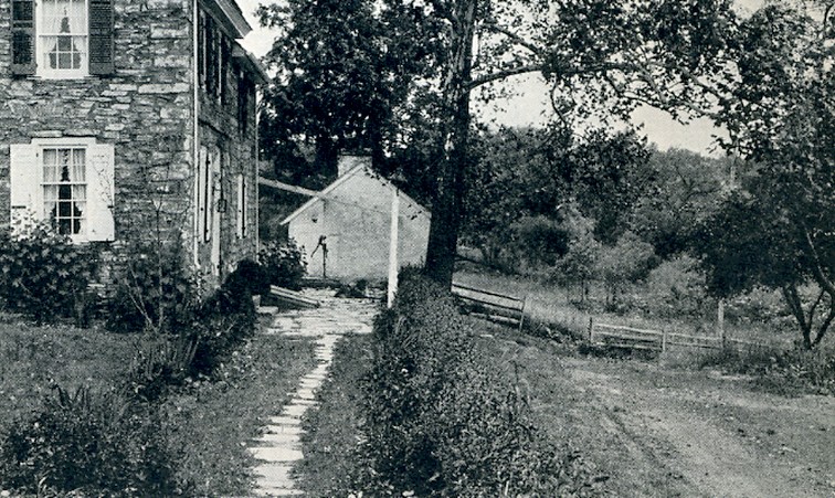
From the
back, up the slope near the rude bridge, just as the magazine
article stated.
You can see how different this looks from the pictures in the
magazine, but now that we know it's the right house it jumps out at
you. |
| |
|
|
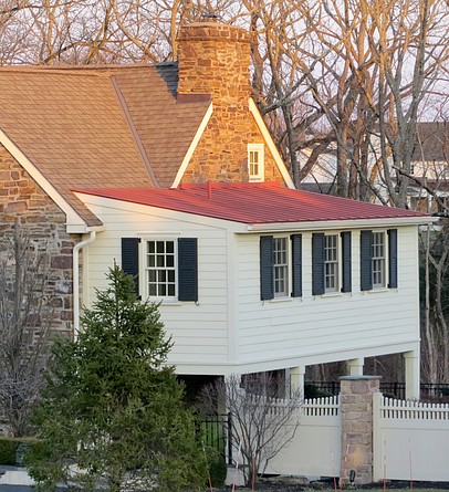
| Looking
down the driveway from Penn Oak Drive. The house has been
practically swallowed up with additions. |
|
|
A few weeks after we found the house, my
sister, Cindi-with-an-eye, called me and said she was
nearby. The doctor she works for was throwing a party at his
house. Guess where the doctor lives. In Robert Evans' house!
We spend two years wondering where the house is and my
sister comes up one time and she's IN the house. I love that
about my sister. |
|
|
| |
|
|
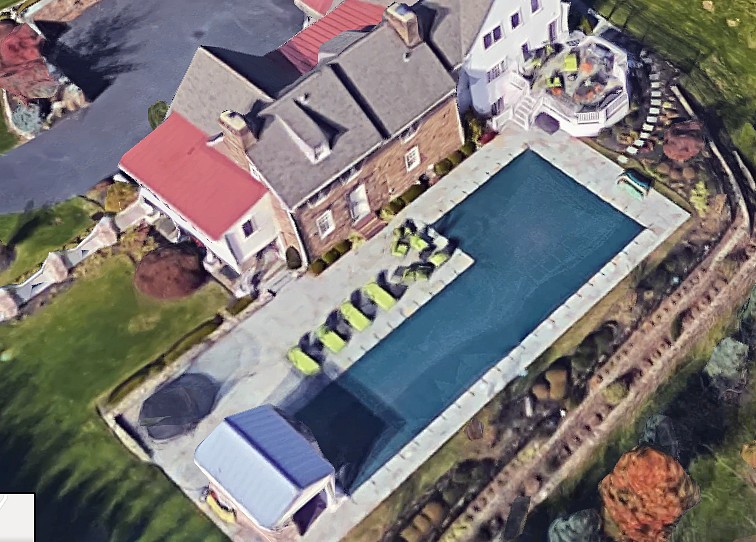
| We'll
never see this view of what used to be the front of the house
again... |
| |
|
|
...
because a swimming pool now occupies the space.
|
|
|
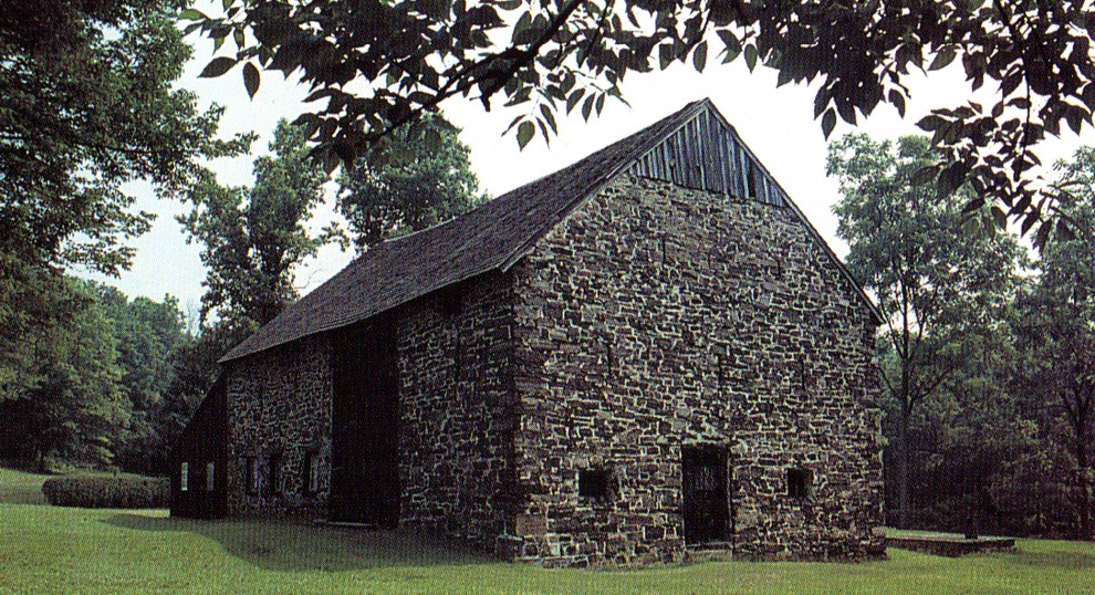
Another mystery! Where is the barn to the house? |
|
|
|
Historian Phil Johnson Ruth
took this photograph around 1990. He included it in his book
Fairland Gwynedd, published in 1991. As far as I can
tell, it is the only photo in the book he took himself. The
caption reads, "The ground-level barn on the Robert Evans
homestead near Gwynedd Corners. Contemporary photo by the
author."
It is now the year 2018.
We have been looking for the barn for years to no avail. Where is it?? It must
be near the house, but how far away? We have looked
everywhere. It turns out we are NEVER going to find it.
Thankfully, Phil took this picture!
|
|
|
|
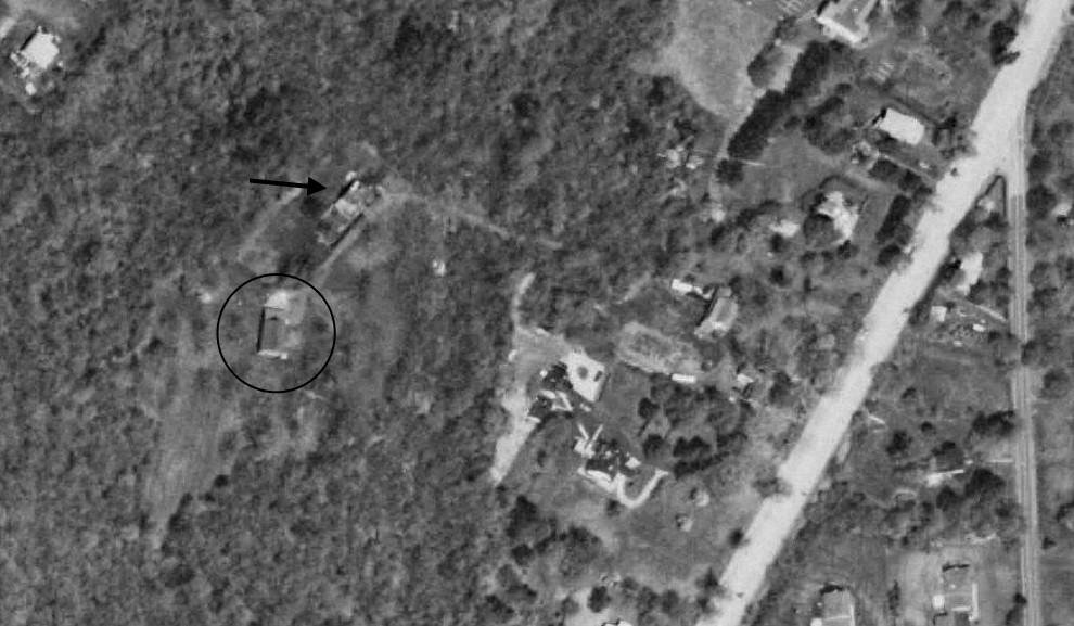
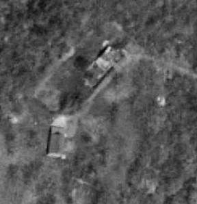
In this fuzzy aerial photo
from 1995 there is no Penn Oak Drive. The Evans house has an
arrow pointing to it. What is the building in the circle? It
has to be the barn. The roof line seems to match with the
color photo. There are no other structures nearby and the
area is still heavily wooded.
Notice the path that leads to the house. This is the path
over the rude bridge we couldn't find, mentioned in the 1927
magazine article.
This is part of a MUCH larger photo of the area that can be
found
here. |
|
|
|
|
|
|
|
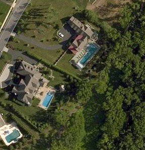
In May of
2007 a
swimming pool was deemed to be more important than a 300 year old barn.
Oh well, at least we "found" it.
|
|
|
| The
location is now completely obscured at ground level in all
directions. |
| |
|
| Chapter
7. We find the home of Thomas Evans! |
|
| |
|
|
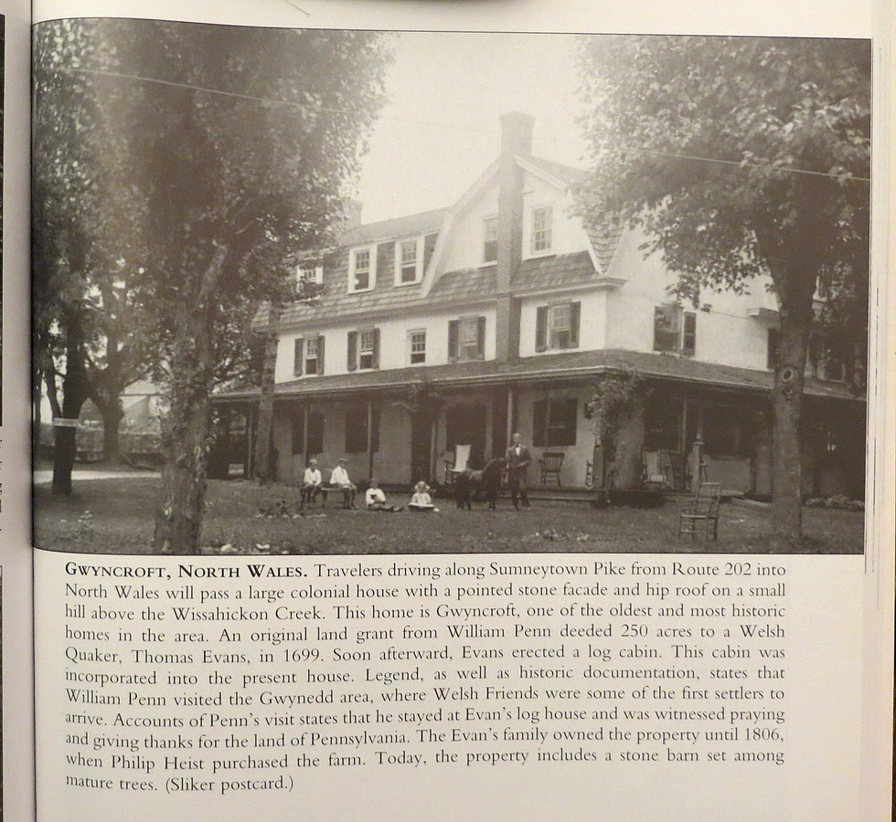
| This is
from The North Penn Community, page 87. It's one of those
historic postcard books. |
| |
|
With no effort on our part, we get a
picture of the Thomas Evans house just by looking at some postcards in
a
book. Time for a walk up
Sumneytown Pike. |
|
| |
|
|
|
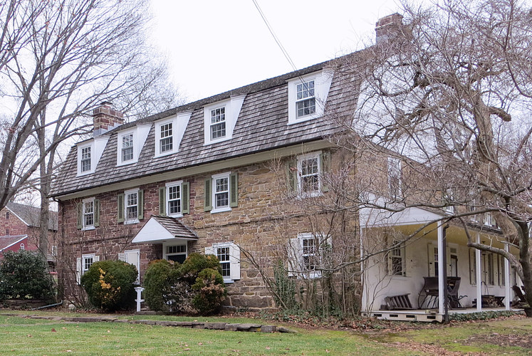
Here is the house, near the intersection
of Sumneytown Pike and Upper Valley road. This side faces
Sumneytown Pike. Compare to the postcard. The stucco has
been removed, and so has the porch. The brick chimney and the dormer
are also gone, leaving a gap in the window spacing. You can still see where the porch roof was attached to the
building. |
|
| |
|
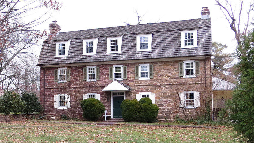
Another view of the front. The back of the building is still stuccoed and is
white, as in the Sliker postcard. |
|
In his will, Thomas Evans granted his house to his son,
Owen. Owen's son Samuel inherited it from Owen in 1757.
Samuel lived in it for years and was a school teacher in
North Wales. My guess is that the original part of the house
is from the left side to the door. It was much smaller 200
years ago before George Heist added the tavern.
|
|
|
|
|
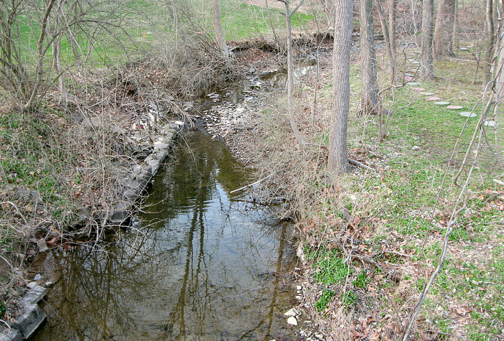
So going back to page 1, what is "Evans Run?" It's a
creek! Who would have thunk it?
The text under the postcard above wrongly states that it's the
Wissahickon Creek. It actually merges with the Wissahickon about 1/2
mile away. |
|
|
Andrea at Evans Run where it goes under Sumneytown
Pike. The Thomas Evans house is in the background. Today the creek
is named "Haines-Dittingers Creek." It is 3.3 miles long but
only runs under one major road, Sumneytown Pike.
The bridge Andrea is standing
on, which spans Sumneytown Pike behind her, was built
in 1848 by Robert Scarlett during the construction of the
turnpike. |
|
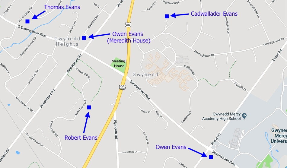
The homes of the other two
Evans brothers, Owen and Cadwallader, have been located on
the 1877
map.
The properties are listed as "E. Evans" and "Bellows," just
as Howard Jenkins wrote in Historical Collections
Relating to Gwynedd.
(Note: the Owen Evans
in the Meredith House was the son of Thomas.) |
|
Here is the
link to the Gwynedd Meeting history pages written by
James A. Quinn. |
|
|
|
|
* UPDATE: DECEMBER
2015
|
|
|
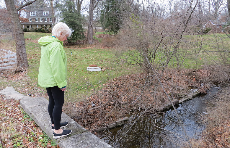
The path over the rude bridge to Robert
Evans' house has been
paved. The impenetrable foliage has been replaced with
grass, and there IS a house at the top of the hill.
Thankfully, we couldn't see this house during our search, or we
would have thought it was the Evans house. Robert Evans' house is BEHIND us in this photo.
The paved path
over the bridge in this view veers off to the left, but it
doesn't go anywhere. It just ends. Prior to 1999 it led up
the hill to the state road, now known as Dekalb Pike, Route
202. The strip of land the path once occupied is currently
owned by the owner of the house in this photo, which was
built in 1917. |
|
|
|
|
|
|
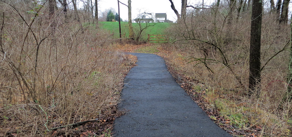
| Turning around, we see the path leads
directly to the Robert Evans house! In 2011 when we found
the bridge it led to and from nowhere. If this paving had
been there in 2011 we may have found the house on the first
day. When we found the post office we were only about 50
feet from where the path once was. This picture was taken in
2018. |
|
|
|
|
|
We now return you to our regularly scheduled program. |
|
|
|
| |