|
Finding History Hidden In Plain Sight |
|
|
Did you read the text in the
magazine article? You have to be a pretty hard core history
buff to want to read the whole thing. Even without reading
the text, we now know what we're looking for thanks to the
pictures.
Though Thomas Evans was a Quaker, Robert Evans belonged to
the Church Of England. The first non-Quaker religious
meetings in Gwynedd were held in Robert Evans house, with
his brother Calwalader as lay-reader. This will make seeing
the actual house even more interesting. Eventually, Robert
and Cadwalader became Quakers and Robert donated the land
for the Meeting House.
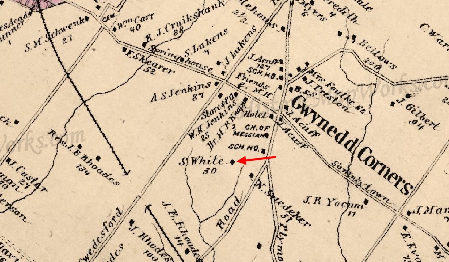
Anyway, we thought this was going to be easy! We have the
statement made by Jenkins that Robert Evans lived "where Silas
White now lives" and the House Beautiful article states to get to the
house you "walk down a long lane, cross a rude bridge over
the feeble descendant of Robert Evans's stream, and climb a
steep slope."
We've even located the
home of Silas White in the map shown below! |
|
|
|
Portion of the J. D. Scott
Montgomery County Atlas 1877
Note: Link to entire map can be found at the bottom of page 5. |
|
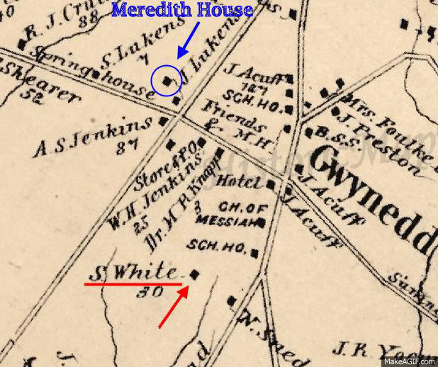
So now let's
overlay a modern map on top of the old one. |
|
|
|
|
We are going to use this map to walk
from the Meredith house to
Robert Evans' house. Note
the thin gray line on the modern map. This is part of the
Lower Gwynedd trail system. We've been down there a hundred
times but have never seen a house. This time we'll take a
good look. |
|
| |
|
|
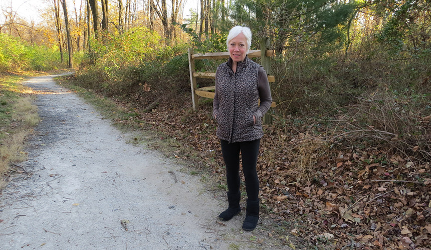
Andrea on the "long lane" leading to the
"rude bridge" during one of our many walks in the area.
Unbeknownst to us, it wasn't the same "long lane" described in
the 1927 article, but it did lead to the same "rude bridge"! |
|
|
|
|
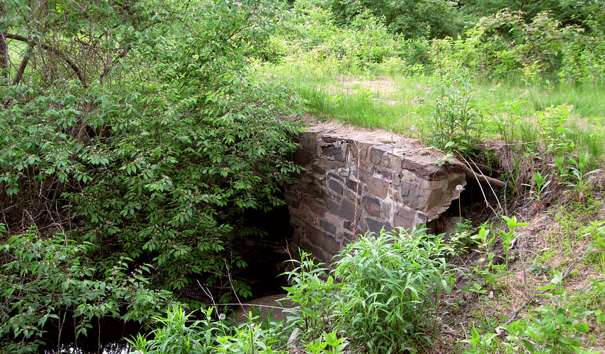
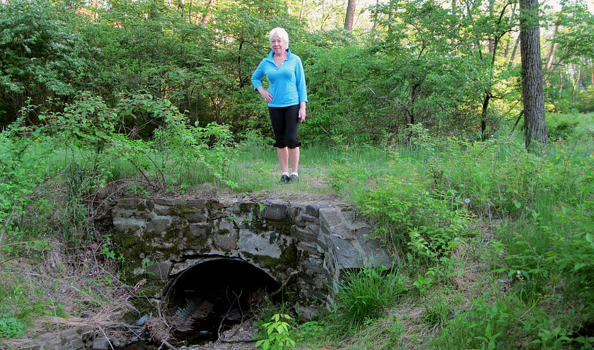
| Here we have found
the "rude bridge"! Actually, we already knew where this was but didn't know
WHAT it was. |
| |
|
|
| Andrea on top of the
"Rude Bridge". July 13, 2011. |
|
|
We crossed over the bridge as we had done
in the past, but this time looking for the Robert Evans
house. We were supposed to climb a steep slope according to
the 1927 magazine article. There was a steep slope in front
of us, but it was choked off with foliage. We climbed it a
bit but then realized there was
nothing there. The bridge seemed to have no purpose. It
didn't go anywhere. We had walked down a long lane and
crossed the rude bridge, exactly as the 1927 article said to
do, but we didn't see any house whatsoever.
*
* There is an update to this at
the bottom of page 5. |
|
|
|
|
|
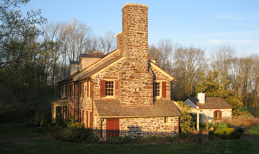
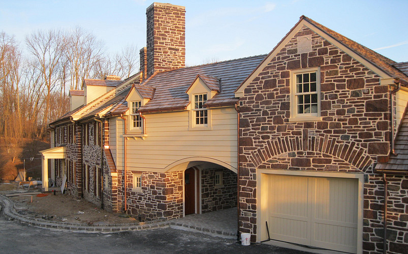
We pass this place on Swedesford Road
when we walk to Evans/Mumbower mill. Even though we felt it
was in the wrong place, one day we stopped and wondered what
it looked like before the additions were built. The owner
came out, a nice lady named Phoebe. We asked her if this
was the Robert Evans house. She said it wasn't, but she had
heard of it and it was around here somewhere. Then she gave
us a complete tour of the house and grounds!
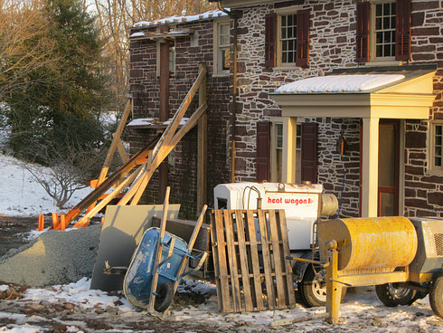
Later, we were thankful we had taken the tour. Phoebe sold
the property and the new owner GUTTED the house. Gutted is
an understatement. At one end of the house the only thing
left was the front wall, held up with an iron girder and
some two by fours. We know the floors came out because we
saw the lumber sitting on the ground. |
|
|
|
|
| These pictures were
taken in 2013. The wall at the left has NOTHING left on the other
side of it. |
| |
|
|
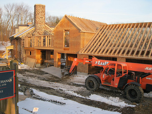
| January 2015. Almost
done. The house has been purged of most of its history. |
|
| Chapter
3. (Not) Locating the home of Robert Evans - Again. |
|
| |
|
|
| |
|
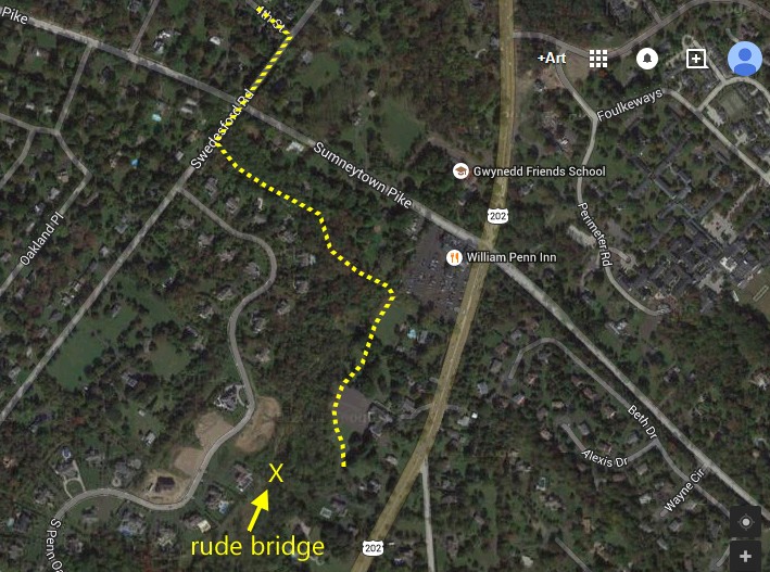
Not finding the house wasn't
a big problem. We walk the area all the
time, and looking for the house just made the walks more
interesting. Since the "rude bridge" must have led to somewhere in
the past, we decided later to attack the problem by heading
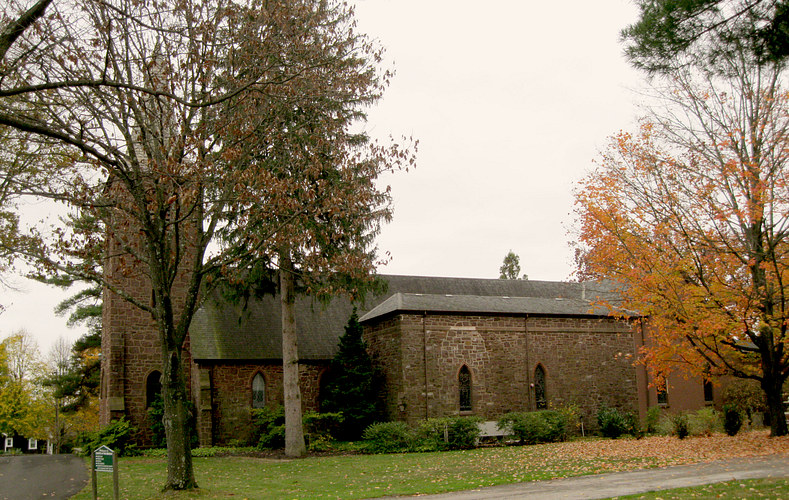
to where it must have once led, the State Road, now Route
202. Above is the route we took, through the graveyard of
the Church of the Messiah and across a parking lot, skirting
the woods, looking for a place to cross the creek that would lead to
the rude bridge. Naturally, Robert Evans' house would be
there. |
|
| |
|
|
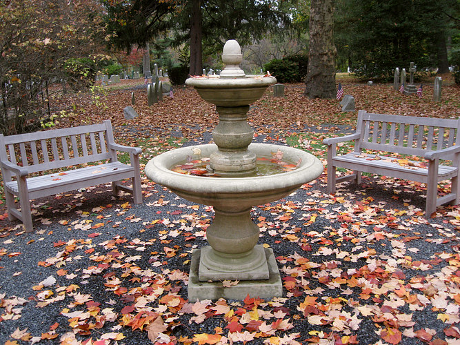
| Church of the Messiah
on Route 202. We spent quite some time exploring the grounds and
cemetery behind it. |
| |
|
|
| |
|
|
|
| |